India State of Forest Report 2023: A Summary
Introduction
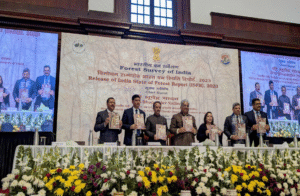
The India State of Forest Report 2023 is a crucial document for understanding the nation’s evolving forest and tree resources. Published biennially by the Forest Survey of India (FSI) under the Ministry of Environment, Forest and Climate Change, this report, often abbreviated as ISFR 2023, provides a detailed assessment of the country’s green cover. Since 1987, the India State of Forest Report has become a key reference, evaluating forest cover (all lands with a tree canopy density exceeding 10%) and tree cover (trees outside traditional forest areas). This analysis of the India State of Forest Report 2023 is tailored for UPSC exam preparation, focusing on the most relevant data and trends.
Key Findings of the ISFR 2023
-
Total Forest and Tree Cover
- The cumulative area of forest and tree cover is 8,27,356.95 square kilometers.
- This constitutes 25.17% of the total geographical area of the country.
-
Forest Cover
- The total area covered by forests is 7,15,342.61 square kilometers.
- This represents 21.76% of the nation’s geographical area.
Tree Cover
- The total area covered by trees outside of forests is 1,12,014.34 square kilometers.
- This equates to 3.41% of the country’s geographical area.
Changes in Forest and Tree Cover
-
Increase in Forest and Tree Cover
- There has been a net increase of 1,445.81 square kilometers in the total forest and tree cover since the 2021 report.
- Specifically, forest cover has expanded by 156.41 square kilometers.
- The states that demonstrated the most significant growth in forest and tree cover are:
- Chhattisgarh: 684 square kilometers.
- Uttar Pradesh: 559 square kilometers.
- Odisha: 559 square kilometers.
- Rajasthan: 394 square kilometers.
- The states that showed the maximum increase exclusively in forest cover are:
- Mizoram: 242 square kilometers.
- Gujarat: 180 square kilometers.
- Odisha: 152 square kilometers.
-
Decrease in Forest and Tree Cover
- Conversely, some states experienced a reduction in forest cover.
- Madhya Pradesh recorded the largest decrease, with 612.41 square kilometers lost.
- Other states with notable reductions include:
- Karnataka: 459.36 square kilometers.
- Ladakh: 159.26 square kilometers.
- Nagaland: 125.22 square kilometers.
States with Largest Forest Cover
-
Area-wise
- The states with the largest forest cover in terms of total area are:
- Madhya Pradesh: 77,073 square kilometers.
- Arunachal Pradesh: 65,882 square kilometers.
- Chhattisgarh– 55,812 square kilometers.
- The states with the largest forest cover in terms of total area are:
-
Percentage of Geographical Area
- The States/Union Territories with the highest percentage of forest cover relative to their geographical area are:
- Lakshadweep: 91.33%.
- Mizoram: 85.34%.
- Andaman & Nicobar Islands: 81.62%.
- Notably, 19 States/UTs have forest cover exceeding 33% of their geographical area.
- Furthermore, 8 States/UTs boast forest cover greater than 75%, including Mizoram, Lakshadweep, Andaman & Nicobar Islands, Arunachal Pradesh, Nagaland, Meghalaya, Tripura, and Manipur.
- The States/Union Territories with the highest percentage of forest cover relative to their geographical area are:
Carbon Stock
- The total carbon stock held within India’s forests is estimated to be 7,285.5 million tonnes.
- This represents an increase of 81.5 million tonnes compared to the 2021 assessment.
- The top three states contributing to this carbon stock are:
- Arunachal Pradesh: 1,021 million tonnes.
- Madhya Pradesh: 608 million tonnes.
- Chhattisgarh: 505 million tonnes.
- India’s overall carbon stock is calculated to be 30.43 billion tonnes of CO2 equivalent.
- Since the 2005 baseline, India’s carbon stock has increased by 2.29 billion tonnes of CO2 equivalent.
- India has set a near-term target to create an additional carbon sink of 2.5 to 3.0 billion tonnes of CO2 equivalent.
-
Northeastern Region:
- The combined forest and tree cover in the Northeastern region is 1,74,394.70 square kilometers, which is 67% of the region’s geographical area.
Mangrove Cover
- The total mangrove cover in India is 4,991.68 square kilometers, accounting for 0.15% of the country’s total geographical area.
- There has been a net decrease of 7.43 square kilometers in mangrove cover since 2021.
- Changes in mangrove cover at the state level include:
- A decrease of 36.39 square kilometers in Gujarat.
- Increases of 13.01 square kilometers in Andhra Pradesh and 12.39 square kilometers in Maharashtra.
Forest Fire Incidents
- The states reporting the highest number of forest fire incidents during the 2023-24 season are:
- Uttarakhand
- Odisha
Chhattisgarh
India’s Commitments
-
Paris Agreement and Nationally Determined Contributions (NDCs):
- India has pledged to enhance its forest and tree cover to create an additional carbon sink of 2.5 to 3 billion tonnes of CO2 equivalent by 2030.
-
Bonn Challenge:
- As part of the Bonn Challenge, a global initiative focused on restoring degraded and deforested lands, India has committed to restoring 26 million hectares of such land by 2030.
Socio-economic Importance of Forests
- A significant portion of the global population and livestock population relies on India’s forests for their livelihoods.
- Specifically, 17% of the world’s human population and 18% of the world’s livestock depend on these forests, highlighting their crucial socio-economic role.
India’s Standing in Global Forestry
- According to the FAO’s Global Forest Resource Assessment (GFRA) 2020, India is among the top 10 countries worldwide in terms of forest area.
- Furthermore, India holds the 3rd position globally in terms of the largest annual net gain in forest cover during the period from 2010 to 2020.
Forest Survey of India (FSI)
- The Forest Survey of India (FSI) was established on June 1, 1981, succeeding the Pre-Investment Survey of Forest Resources (PISFR), which was initiated in 1965.
- The establishment of the FSI was based on a recommendation by the National Commission on Agriculture in 1976, which called for the creation of a dedicated National Forest Survey Organization.
- The FSI operates under the Ministry of Environment and Forests, Government of India.
- Its primary function is the regular assessment and monitoring of India’s forest resources.
- In addition to its assessment role, the FSI also provides training, conducts research, and offers extension services.
- The FSI is headquartered in Dehradun and has regional offices in Shimla, Kolkata, Nagpur, and Bangalore, along with a sub-center in Burnihat (Meghalaya).
Trends in Forestry Parameters (2013-2023)
-
Increase in Greenery:
- Over the past decade, there has been a notable increase in India’s green cover.
- Forest cover has expanded by 16,630.25 square kilometers.
- Tree cover has increased by 20,747.34 square kilometers.
- Mangrove cover has also grown, with an increase of 296.33 square kilometers.
-
Soil Health:
- Overall, there has been an improvement in soil health.
- The proportion of soil classified as shallow to deep has increased from 83.53% in 2013 to 87.16%.
- This indicates a positive change in humus content, which contributes to soil fertility.
- Soil Organic Carbon (SOC) levels have also risen from 55.85 tonnes per hectare in 2013 to 56.08 tonnes per hectare in 2023.
- SOC, defined as the carbon stored within soil organic matter, is crucial for enhancing soil structure, stability, and aggregation, thereby promoting overall soil health.
Biotic Influences on Forests
- There has been a reduction in biotic influences on forests, decreasing from 31.28% in 2013 to 26.66% in 2023.
- This decline suggests an improvement in floral biodiversity and more favorable conditions for faunal biodiversity.
- “Biotic influences” encompass the impact of living organisms on forests, including:
- Grazing and Browsing: The consumption of plant material by animals.
- Man-Made Fires: Forest fires caused by human actions.
- Pollarding and Lopping: The cutting of tree branches for purposes such as fodder or fuel.
- Illicit Felling: The unauthorized cutting down of trees.